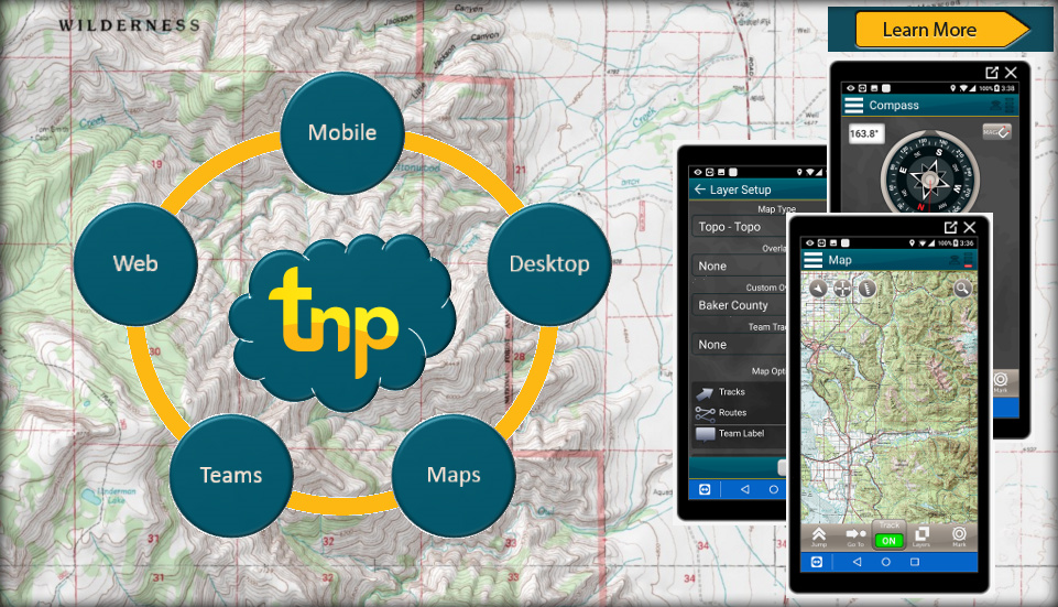


Terrain Navigator Pro is a robust mapping platform combining built-in topographic maps and aerial photos with easy-to-use mapping tools. Create map projects, annotate, edit, collect, import and export GIS data and maps and synchronize across desktop, web, and mobile devices. Output professional map products quickly and easily.
Premium Ownership adds private land plat maps, including boundaries, assessor’s parcel number (APN) and ownership information for over 85% of the US. View and query ownership information in the office and field, and see your location in real-time relative to private and public property boundaries.
