

TNP for Teams is designed to be deployed during large-scale search and rescue operations, environmental cleanups, and multi-state conservation projects with teams using their mobile devices to collect and visualize data. TNP for Teams synthesizes and displays collected data to speed in-the-field decision-making and creates a digital record of all field activity.
TNP for Teams seamlessly integrates powerful desktop mapping software, a cloud-connected mobile data collection platform (compatible with all GPS-enabled iOS and Android devices), and a robust Web portal. TNP for Teams users can plan projects in the office, collect data in the field, and access projects from the Web—simultaneously. Geo-referenced data such as tracks, waypoints, photographs, and video can be shared, updated in near real-time, and displayed on the included topographic, aerial/satellite, or street base maps. Individual team members are permitted to view and manipulate data, and to locate fellow team members in the field or from the office.
Organizational Structure
- The purpose of the organization is to create a structure to assist in segregating the projects appropriate to geography, territory, or other arbitrary collection suitable to the customer.
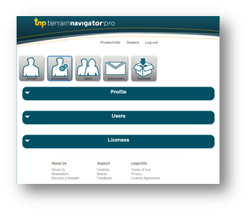
- From the web interface, the customer’s administrator can manage users, teams, devices, licenses, and subscriptions.
- Users of the system can also manage their own information, providing each customer with complete self-management of their TNP resources.
Primary Components
Organizations
- Once a customer activates two or more subscriptions for the same organization, they are provided with a primary account to manage licenses, privileges, users, teams, and projects for their business.
- Each user subscription includes access to desktop software, mobile applications, and web applications to use interactively between these platforms to match the task at hand.
Desktop, Mobile, and Web
- Two installations (a primary and a backup) of the PC desktop client are available to each named user in an organization. Map data is licensed by the state (or region in Mid Atlantic and New England states.) Additional states can be added to the licensed area.
- In addition to the desktop software, each named user has access to mobile and web applications.
- If an organization has two or more subscriptions (in the same account) then the Team Tracking and sharing features are automatically enabled when users across all three TNP platforms (PC desktop, mobile app, and web portal.)
- The desktop software has a robust set of mapping features; the web portal and mobile apps are designed for quick viewing, limited editing, and navigation/data collecting in the field.
Additional States
- If a specific desktop client requires more than one state/region, additional states/regions can be purchased and assigned to a specific user that already has a desktop client license.
|
What are Teams?
|
|
|
What is Team Tracking?
- Bill May, Rocky Mountain Rescue Group, Inc.
|
|
|
|
