

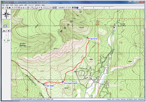
 TNP includes immediate access to the final, highly-detailed edition of traditional USGS topo maps for the continental US: 1:24/25,000 (7.5 minute series), 1:100,000 scale and 1:250,000 scale. (Alaska is 1:63,360 and 1:250,000 scale)
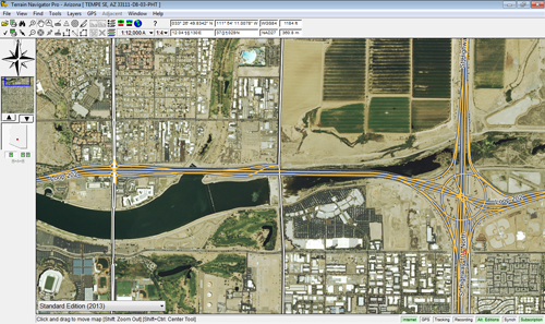 TNP includes aerial orthophoto coverage for the entire lower 48 United States. 1-meter (1:12,000 scale) photos are available everywhere, with high-resolution (up to 1:3600 scale) urban imagery in many metropolitan areas. All areas feature color photography taken within the last two years.
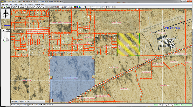
Terrain Navigator Pro integrates land ownership parcel boundaries* as part of an optional additional data subscription. Once downloaded to the desktop, parcels can be searched and shown on the desktop without an Internet connection.
The yearly parcel data subscription includes instant, integrated access private land ownership details such as:
*Private land boundaries should not be considered a legal survey and should only be used for informational purposes. Private land ownership details and boundaries are not available in all cities and towns.

Note: Coverage as of January 2021 for TNP on the PC platform; TNP Mobile App (Android/iOS) coverage is slightly reduced. Partial coverage means 25% - 75% of the parcels include boundaries and owner information for a specific county. Counties in white have either no data or less than 25% parcel coverage.

Alabama

Arizona

Arkansas

California

Colorado

Connecticut

Delaware

Florida

Georgia

Idaho

Illinois

Indiana

Iowa

Kansas

Kentucky

Louisiana

Maine

Maryland/D.C

Massachusetts

Michigan

Minnesota

Mississippi

Missouri

Montana

Nebraska

Nevada

New Hampshire

New Jersey

New Mexico

New York

North Carolina

North Dakota

Ohio

Oklahoma

Oregon

Pennsylvania

Rhode Island

South Carolina

South Dakota

Tennessee

Texas

Utah

Vermont

Virginia

Washington

West Virginia

Wisconsin

Wyoming
